The Weather Below Is Cloudy.

F/10.0, 1/400, ISO 320.

Mount San Jacinto State Park ( Desert View Trail )

 What do you call lice on a bald man’s head?
Homeless.

Interesting Fact: The Mount San Jacinto State Park encompasses the weathered granite summit of Mount San Jacinto, which at 10,834 feet (3,302 m) above sea level[2] makes this the second highest peak and mountain range in Southern California. It is accessible by the Palm Springs Aerial Tramway and lies on the Pacific Crest Trail. ( https://en.wikipedia.org/wiki/Mount_San_Jacinto_State_Park )

I’m Higher Than I Expected!

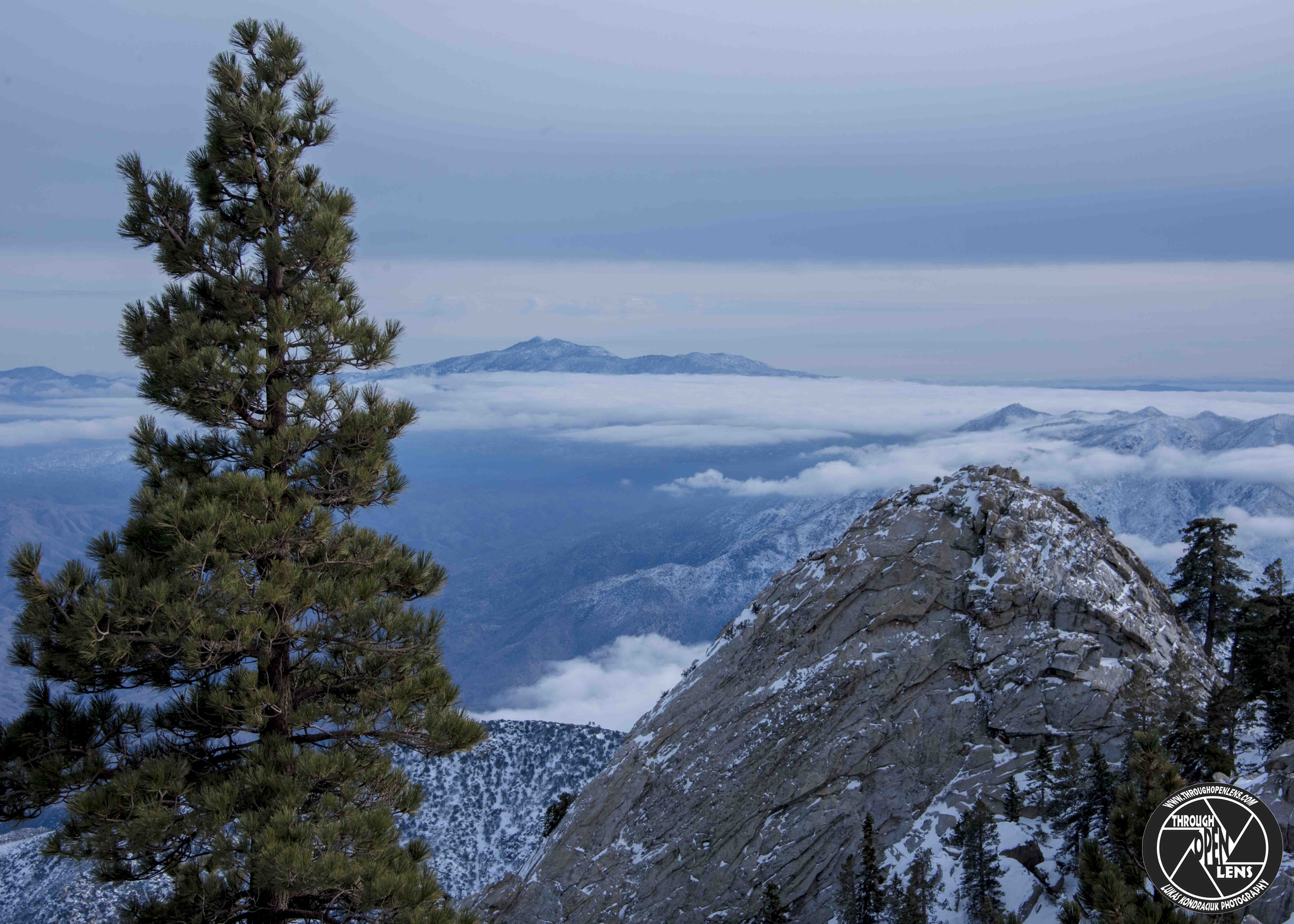
F/13.0, 1/500, ISO 320.

Mount San Jacinto State Park ( Desert View Trail ) 

What kind of undies do clouds wear?

Thunderwear.

Interesting Fact: The San Jacinto Mountains, like the neighboring San Bernardino Mountains, are a humid island above the surrounding desert and semi-desert. Annual precipitation ranges from about 15 inches at the western base (and only 6 inches on the eastern, desert base) to as much as 32 inches above 5,500 feet (the mountain town of Idyllwild averages 27 inches per year). The coastal (western) side of the range receives more precipitation than the eastern (desert) side. Most of the precipitation falls between November and March, with a secondary maximum associated with thunderstorms during the summer monsoon season between July and September. The precipitation totals are highly variable from year to year. Snow usually falls above 4,000 feet elevation in winter. Above 8,000 feet, snow sometimes persists until June. Near the crest, there are often a few patches of snow that may persist all year in shady spots. ( San Jacinto Mountains – Wikipedia )

Do You Even LIFT BRO?l

F/10.0, 1/400, ISO 320.

Mount San Jacinto State Park 

What is a pretzel’s favorite dance?

The twist.

Interesting Facts: The Palm Springs Aerial Tramway in Palm Springs, California, is the largest rotating aerial tramway in the world. It was opened in September 1963 as a way of getting from the floor of the Coachella Valley to near the top of San Jacinto Peak and was constructed in rugged Chino Canyon. Before its construction, the only way to the top of the mountain was to hike hours from Idyllwild. The rotating cars were added in 2000. ( Palm Springs Aerial Tramway – Wikipedia)

Just Sitting Here On The Corner Of Awesome And Bombdiggity.

F/8.0, 1/125, ISO 100.

Peregrine Falcon

Why did Mickey Mouse go to space?

To visit Pluto.

Interesting Fact: The Peregrine Falcon is one of the most widespread birds in the world. It is found on all continents except Antarctica, and on many oceanic islands. ( https://www.allaboutbirds.org/guide/Peregrine_Falcon/lifehistory )

I’m On Top Of The World!

F/11.0, 1/500, ISO 320.

Mount San Jacinto State Park ( Desert View Trail )

Why did the snowman call his dog Frost?

Because frost bites!

Interesting Fact: Mount San Jacinto State Park is in the San Jacinto Mountains, of the Peninsular Ranges system, in Riverside County, California, United States. A majority of the park is within the Santa Rosa and San Jacinto Mountains National Monument.[1] The park is near the Greater Los Angeles and San Diego metropolitan areas.  ( https://en.wikipedia.org/wiki/Mount_San_Jacinto_State_Park )

What Do You See In The Clouds ?

sky clouds

F/13.0, 1/640, ISO 160.

What is a clouds favorite drink?

Mountain Dew

Interesting Fact: Cloud types in the troposphere, the atmospheric layer closest to Earth’s surface, have Latin names due to the universal adaptation of Luke Howard‘s nomenclature. It was formally proposed in December 1802 and published for the first time the following year. It became the basis of a modern international system that classifies these tropospheric aerosols into five physical forms. These physical types include stratiform sheets, stratocumuliform rolls, ripples, and patches, cirriform wisps and patches, cumuliform heaps of variable size, and very large cumulonimbiform heaps that often show complex structure. Most of these forms can be found in the high, middle, and low altitude levels or étages of the troposphere. (  https://en.wikipedia.org/wiki/Cloud )